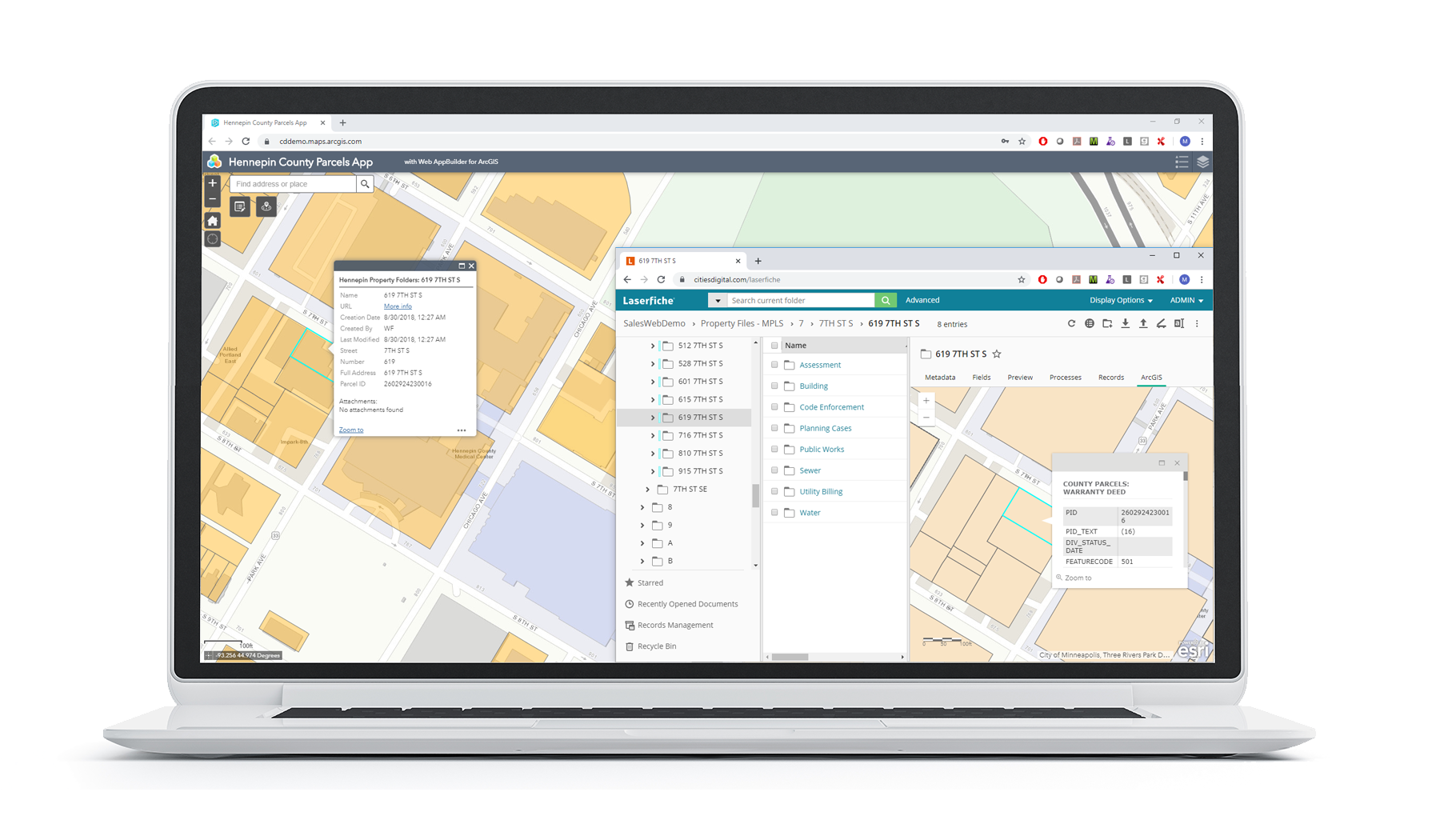
CDI’s ArcGIS Integration with Laserfiche provides time-saving interaction between the ArcGIS interface and Laserfiche. This integration allows users to view, search, and upload documents directly into Laserfiche through the ArcGIS interface.
The dynamic ArcGIS map will auto-populate to indicate which features on the map have Laserfiche stored documents associated with them. Documents, folders, and their metadata from Laserfiche are displayed as ArcGIS feature services, allowing for full functionality provided with ArcGIS 10.1. Documents within folders are displayed as attachments within the feature layer and are viewable within Laserfiche Web Access or WebLink.
ArcGIS is used by governments, industries, NGOs, and Fortune 500 companies around the world. The ArcGIS Integration can be utilized in numerous ways to improve a firm’s planning & analysis, operational awareness, field data collection, asset management, community engagement, and much more. These features, combined with the advanced document management capabilities of Laserfiche, create a powerful and invaluable tool beneficial to any size organization.
- Documents or folders from Laserfiche can be made available as read-only for public users or read/write for internal users.
- Laserfiche layers are created from existing ArcGIS layers, allowing metadata from Laserfiche to be mapped to fields within ArcGIS layers. Multiple Laserfiche layers can be created to expose multiple sets of documentation.
- Feature services allow for all functionality compatible with ArcGIS Server 10.1 or higher. ArcGIS administrators are able to work with the Laserfiche layers as if they were hosted in ArcGIS.
- Documents or folders in Laserfiche are immediately available on the map as geo-coordinates are pulled in real-time from ArcGIS.
- Attributes from ArcGIS can be retrieved and displayed on the map with the Laserfiche documentation
- Documentation can be retrieved from Laserfiche based on Template, Field, and/or Folder Path within Laserfiche.
ArcGIS® Integration by CDI with Laserfiche
Price: $8,000
ArcGIS® Integration by CDI with Laserfiche Annual Maintenance
Price: $1,600
Product Version Number: V1.3.0
Languages Supported: English
Required Products: Laserfiche 9.0 or higher and ArcGIS® 10.0 or higher
CDI is a document management solutions provider specializing in creative solutions using Laserfiche. We’re proud to be partnered with Laserfiche since 2002. Our trusted solutions, built by CDI, have benefited hundreds of Laserfiche customers. The CDI suite of products is designed around expanding the functionality of ECM through more innovative integration.
Product Version Number: V1.3.0
Languages Supported: English
Required Products: Laserfiche 9.0 or higher and ArcGIS® 10.0 or higher
